
Mount Underwood wildfire more than doubles; Evacuation Order south of Port Alberni (V71498)
Overnight growth more than doubled the fire size. ACRD issues an Evacuation Order and Local State of Emergency. Franklin River Road is closed; China Creek Park evacuated. Officials report no threat to Port Alberni or Bamfield.
Live wildfire tracker
Incident V71498 — Wildfire
The Mount Underwood wildfire has more than doubled in the last 12 hours, according to early Tuesday updates. Authorities have issued a Local State of Emergency and an Evacuation Order for areas south of Port Alberni.
See live conditions and official feeds: Open the map
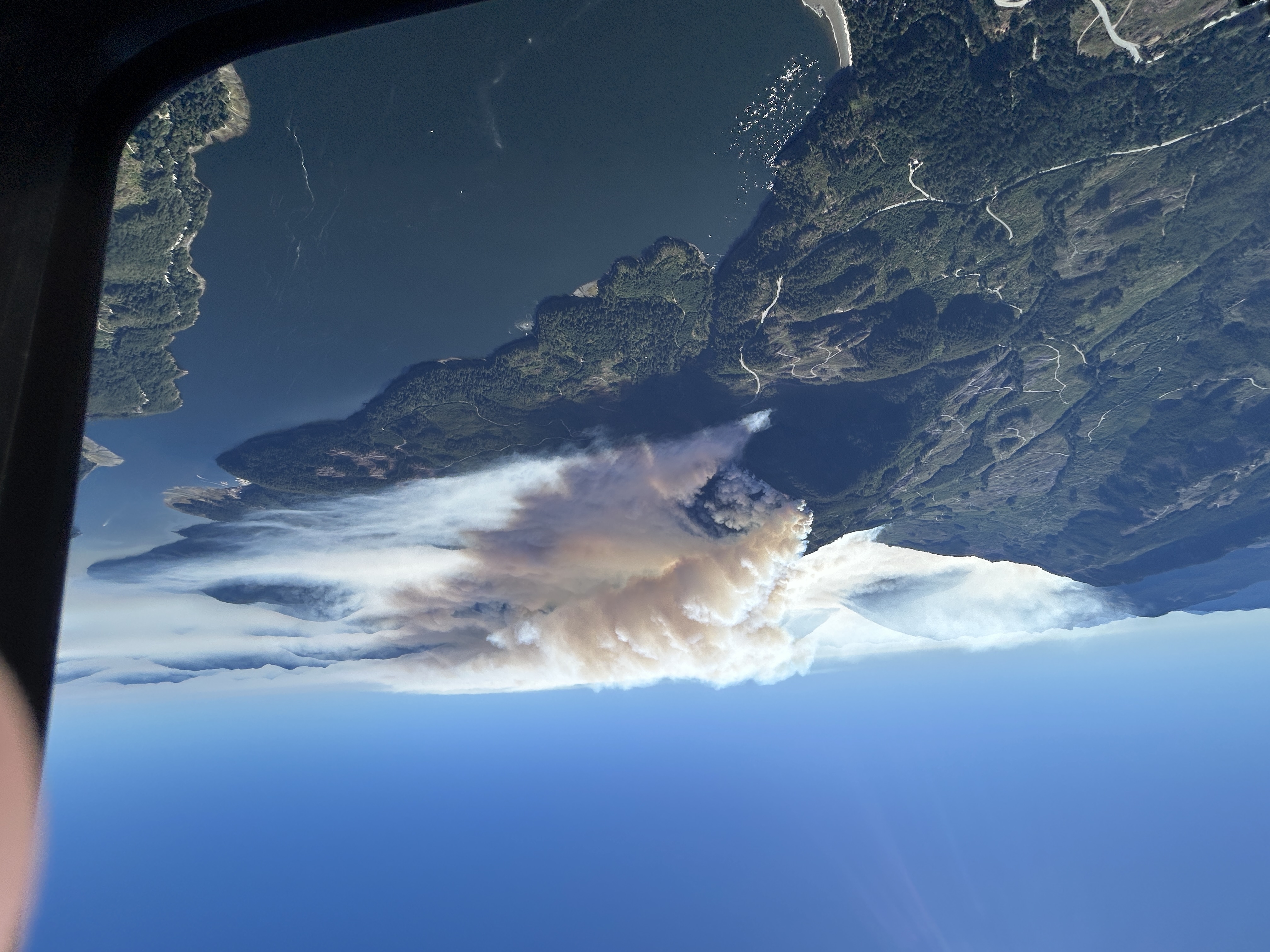
Mount Underwood Wildfire Growth — The wildfire on August 12, 2025, showing significant expansion from the previous day. Photo: BC Wildfire Service
What we know
- Status: Out of Control; fire behaviour reported at Rank 4–5
- Location: ~12 km south of Port Alberni, off the highway between Port Alberni and Bamfield (Bamfield Main)
- Resources: Initial Attack crew, air tanker, 4 helicopters (including night‑vision), and structural protection specialists. A Type 1 Incident Management Team is en route and is expected to assume command Thursday.
- Proximity: ~19 km southwest of the Wesley Ridge wildfire (V71145)
Closures and impacts
- The road between Port Alberni and Bamfield is closed (Franklin River Road).
- Traffic control is in place from Cameron Shop through the Franklin River Road, Bamfield Main, and Cameron Main junction (road to Youbou).
- China Creek Regional Park & Campground is in proximity to the fire and has been evacuated.
- Bamfield currently has no power and limited services. Please check BC Hydro’s outage listings.
- Officials ask non‑residents to avoid travelling to Bamfield by road or trail to reduce pressure on the community.
For the latest on roads, visit DriveBC. For outage details, see BC Hydro Outages.
Evacuation Order and alerts
On August 12, 2025, the Alberni‑Clayoquot Regional District (ACRD) issued both a Local State of Emergency and an Evacuation Order related to this incident.
If you are in an affected area, follow instructions from local authorities and be prepared to leave immediately.
Official sources and live updates
- BCWS incident page (V71498): wildfiresituation.nrs.gov.bc.ca/incidents?fireYear=2025&incidentNumber=V71498
- Open our State of the Island Map: /map
Earlier coverage
- Backgrounder (Aug 11): Mount Underwood wildfire (V71498) out of control at ~630 hectares
What you can do
- Report a wildfire: 1‑800‑663‑5555 or *5555 on cell
- Check bans/restrictions: BCWS Fire bans and restrictions
- Follow local orders: ACRD and municipal channels; stay tuned to official updates
—
Editor’s note: Posted Aug 12, 2025. We’ll update this story as officials post new information.