
Wildfire
Wildfire visible from space: Mount Underwood (V71498)
Daily satellite imagery shows the Mount Underwood wildfire clearly — a new blaze that sprouted south of Port Alberni on Aug. 11.
Van Island News Staff
August 11, 2025
2 min read
Live wildfire tracker
Incident V71498 — Wildfire
Data from BC Wildfire Service. Values update as the official feed refreshes.
Live view with updates: Open our State of the Island Map
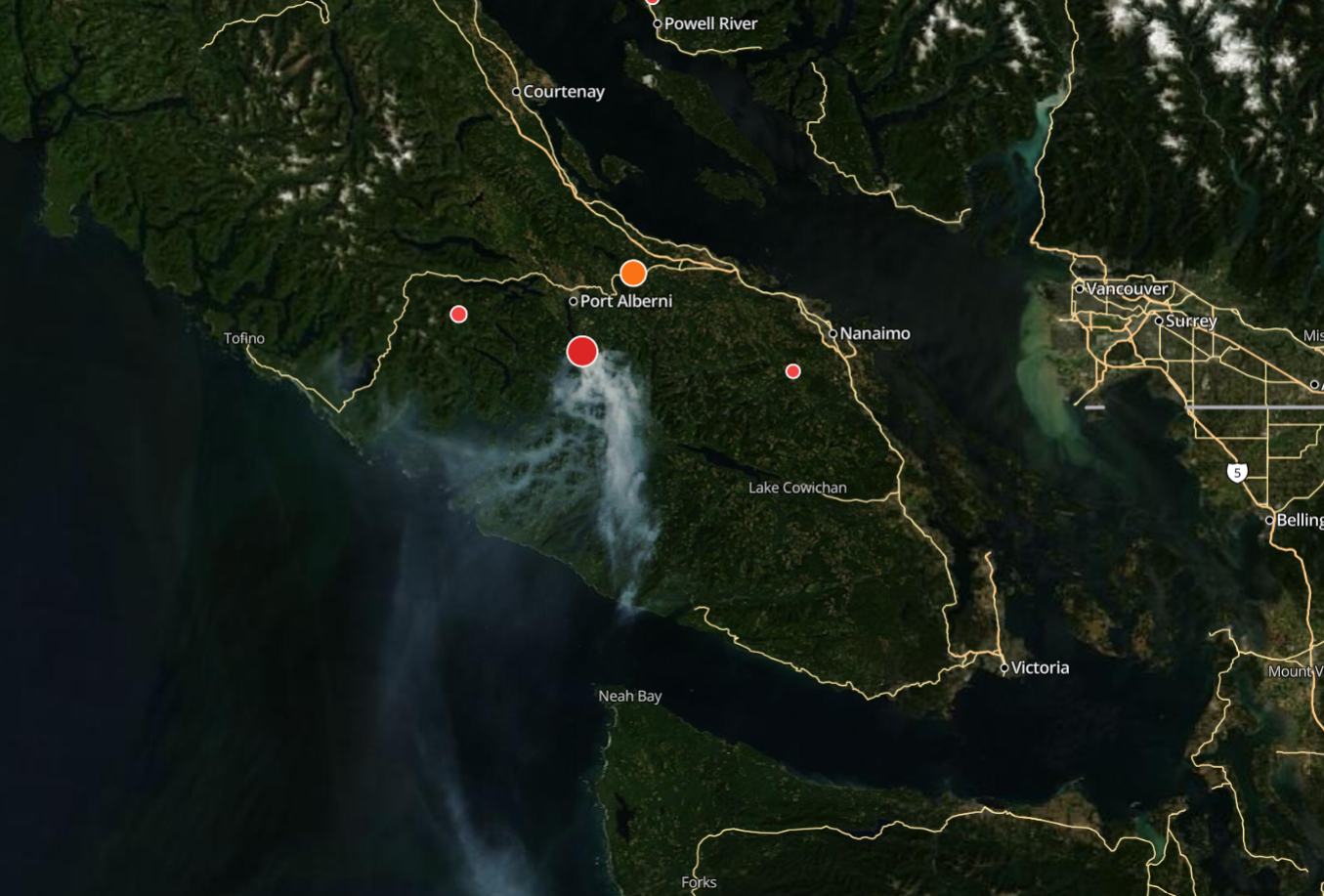
Wildfire Visible from Space — In the center you can see the new wildfire that sprouted up below Port Alberni on 8/11.
Imagery updates daily; boundaries/points from official feeds update throughout the day.
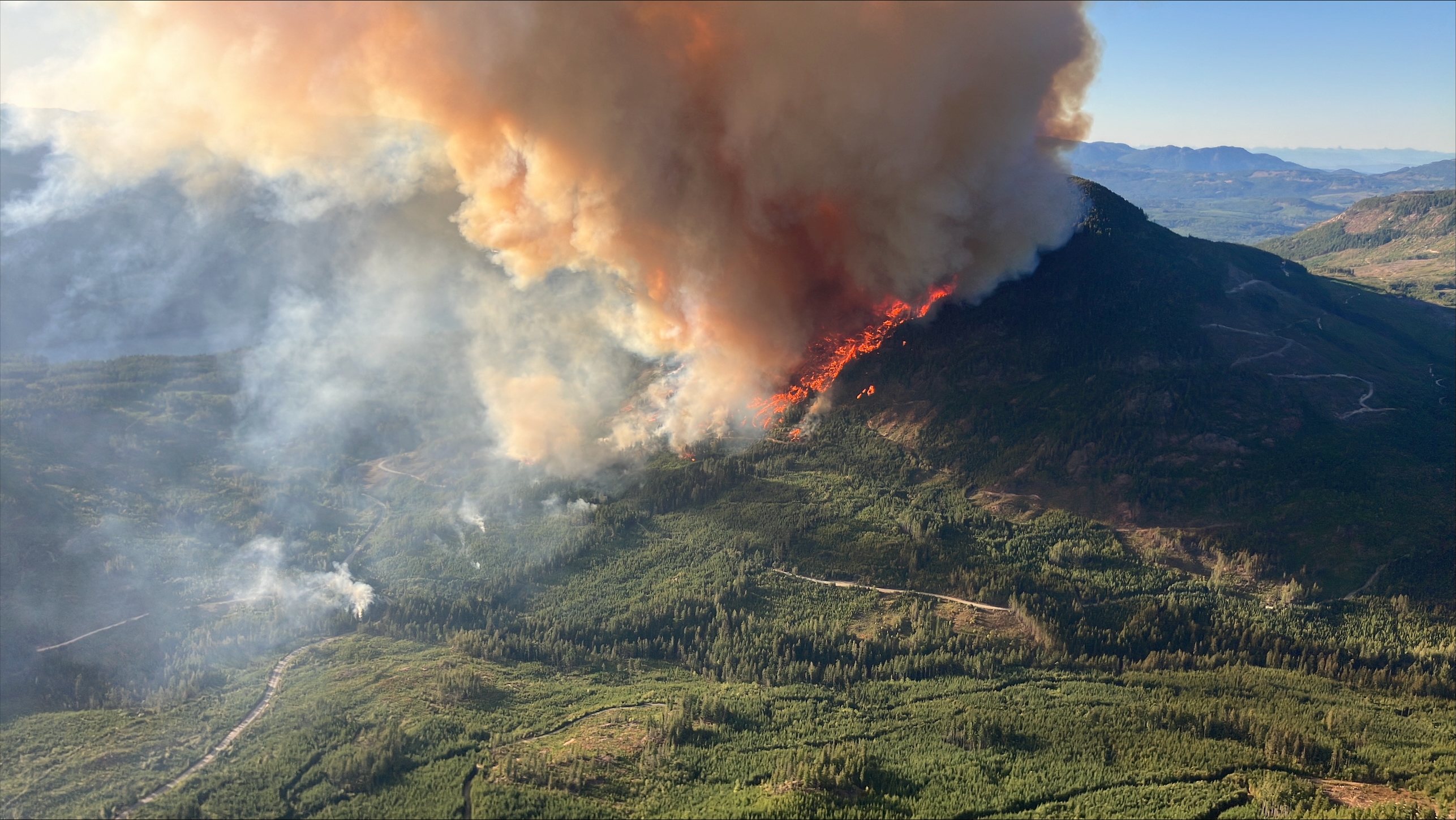
Ground-Level Perspective — The Mount Underwood wildfire as seen from ground level, showing the fire's behavior and intensity. Photo: BC Wildfire Service
Context
- Incident: Mount Underwood (V71498)
- Discovered: 2025‑08‑11
- Status: See current status and size on the BCWS incident page and our live map
Quick links:
- BCWS incident page: wildfiresituation.nrs.gov.bc.ca/incidents?fireYear=2025&incidentNumber=V71498
- Our live map (wildfires layer on): /map#layer=wildfires
Earlier coverage
- Aug 12: Mount Underwood wildfire more than doubles; Evacuation Order south of Port Alberni (V71498)
- Aug 11: Mount Underwood wildfire (V71498) out of control at ~630 hectares
---
Editor’s note: Posted Aug 13, 2025. We’ll continue to add visual context as fresh imagery becomes available.
Tags:wildfireMount UnderwoodPort AlbernisatelliteBC Wildfire ServiceV71498